I like to think of my brain as a computer. Not because it is an efficient, well engineered machine; but because it takes a long time to boot up in the morning and is prone to “insufficient storage” errors. The following experiences along the Alaska Highway have thoroughly taxed all of my system resources.
June 18
I rolled up my wet tent and hit the road. The skies were thick with dark, ominous clouds so I put on my rain gear before even departing. There was some nice mountain scenery, but I had a hard time enjoying it since a sense of dread was occupying my thoughts. I was already cold. Soon I would be cold and wet.
The rains came just about the time I began to make my ascent to Summit Lake. This is the highest point along the entire Alaska Highway, reaching just over 4,200 ft.

Quick side note: I’m making Sonic wear a rain bonnet until I have him fully waterproofed. He’s kind of self conscious about it so please don’t say anything about it to him. 🙂
The climb caused both my ears to pop;
While down the scale degrees did drop;
And then despite my futile hurries;
The rain transformed to bitter flurries;

Shortly thereafter, my camera popped off of its mount and crashed to the pavement. Thankfully I was in a spot where I could pull over to retrieve it. This was my low point. I questioned many things, most notably why I was doing this stupid trip in the first place. Looking back on it now, I’m not sure why I didn’t just pull over and wait it out. Maybe because there was no real way to get any sort of shelter. Wetness and coldness were inevitable. Might as well make some miles. I learned later on from others who had driven the route that the temperature had dropped down to 2 deg C (36F).
Though I think this drive was possibly one of the most scenic stretches I have traversed thus far, I can’t be sure. All of my computing power was focused on remaining on the road and suppressing my shiver reflex. There was not sufficient RAM available to soak in the experience of what I was doing. I’ve since scolded myself for this and it will be a lesson learned that I apply further down the road.
Coming down from the summit the conditions changed rapidly. Clouds split, the sun came out and the temperature rose dramatically. Rita, my guide from the day before, had informed me that I would be stopping for a soak at the Liard Hot Springs. At that moment I would have stopped for anything with the word “hot” in it. It was only $5CAD to get in. A deal!
The Liard Hot Springs prides itself on being a “natural” hot spring. There is no supplemental heating, no tiled floor and the water maintains that sulfuric smell.

The spring in the foreground is the hottest part of the pool. It is difficult to even stand near it. The temperatures get gradually cooler downstream.
It was a great experience, especially since it had been a few days since I’d showered. I could feel the overlapping layers of sunscreen and bug spray successively washing off of me. I also met some real interesting people and had some good conversations. It felt strange going from being so cold to being so hot. I removed 7 layers of clothing from my torso before putting on my bathing suit.

Thanks to my new friend from South Bend, IN for taking this picture and not dropping my phone into the steamy water. 🙂
Feeling like my hard drive was now defragmented, I carried on in much better spirits. The section immediately after the hot springs was the best one so far for wildlife. I got to see my first bull moose, whose antlers looked to be about the same size as my bike. There was a half mile stretch where I saw a group of bison, a red fox and then a grizzly bear in quick succession.

Even though their size is kind of terrifying, it is great to see buffalo in the wild.
The Alaska road actually crosses into The Yukon (that seems to be the way it is said up here….like The Ohio State) three times, so there are multiple opportunities to get a picture of the sign.

This territory is probably most well known for inspiring the Bee Gees 1977 hit “Stayin’ Alive”: “Well, Yukon tell by the way I use my walk……”(Someone help! I’m turning into my father!)
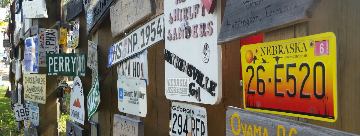
First stop in The Yukon was at Watson Lake, home of the signpost forest.

What began as a homesick soldier adding his hometown to a signpost here has transformed into a collection of over 100,000 signs. People from all over the world have left their mark here. The scale is unfathomable.

Chicopee, MA. A future stop on the road to Everywhere:

I told Sonic I was going to tack him up and leave him here. His facial expression showed no amusement at the joke.
I thought it would be neat to find a sign from Nebraska, so I began to browse. Less than a minute into my search I saw possibly the last thing I would have ever expected to see. When confronted with such an experience, my mental processor begins buzzing trying to calculate the odds of such an occurrence. These odds proved too great and my system crashed almost immediately. The last message my brain was able to send was a directive for my jaw to go slack. So there I stood, mouth gaping, when I was this:

Anyone who knows about Wausa, NE should have their chins nestled neatly on their keyboards. For others, let me explain: Wausa is a Swedish community of about 600 people in Northeast Nebraska. It is the town where both of my parents grew up, my Dad in town and Mom on a farm 6 miles to the north. I simply could not believe my eyes. Seriously, what are the odds? Even if I had known there was a sign from Wausa here, I could have spent all day day searching through the haphazard rows and still not have found it.
Does. Not. Compute.
The campground for the night was a provincial park a bit to the west of Watson Lake. What a crazy day.
June 19
I started early and continued west. I got to see my first pair of Caribou shortly after departing. I arrived in Whitehorse, Yukon around noon and tried to find some good internet. Neither the visitors center, nor the Tim Horton’s down the street offered enough bandwidth for my purposes (though the sugar loop donut was on point). It was a bit strange to be in a city again, seeing lots of stop lights, parking meters, homeless people and dreadlocks.
Leaving Whitehorse, I decided to set an ambitious goal to make it to Alaska by the evening. My daily dose of dampening took place shortly after leaving town and persisted for a couple of hours.
The ride was fairly peaceful and uneventful, then out of nowhere a mountain range appeared.

I’m not sure why I was so struck by this range, maybe it was the flat countryside that approached them, but it was one of the most intimidating ranges I had ever seen. I was sure that at any moment these mountains were going to shuffle over and demand my lunch money from me.
From a roadside sign, I learned that these were called the Icefield Ranges. They are the tallest mountains in Canada (take that, Banff).

The scenery for the next couple of hours was some of my favorite of the whole trip. Amazing contrasts between mountains, rivers, lakes, forests and marsh lands. The road was winding, exciting and missing in some places. 🙂
I had another moment where my internal processor could not truly believe what I was seeing. I rode for awhile with my left palm facing the sky and shoulders shrugged.

Right after this, the SD card in my camera became corrupted and there is no more footage of the beautiful ride. 😦 Thankfully though, I will get to take this same route again when I head back south.

I had a near disaster when my snap in mount for my phone broke free on one of the many heaves in the road. Time slowed down as I watched my phone soar gracefully, yet precariously, into the sky. By some miracle, the charging cord halted its ascent and led it to plop harmlessly onto my left thigh. The proudest accomplishment of my life is owning a smartphone since 2010 and still never cracking a screen. The streak continues….for now.
Finally made it to Alaska around 10pm, Yukon time. Thanks to my new friends from Brazil for snapping this picture. They are riding all the way to Prudhoe Bay before turning around and heading home.

My destination for the night was the first free campground across the border. I laid my tired bones to rest at Deadman Lake (not nearly as ominous as it sounds). There was actually a volunteer site host there when I arrived. She was super helpful and made sure I found a great place for the night. It is rare to get such service, even and paid campgrounds.
My mileage totaled over 600 for the day. My longest day in the saddle by some distance. As I shut down my system for the night I had felt a little more at home now that I was in my own country. This, despite the fact that I was so far from home. What a crazy couple days.
BA

Bob and I love following your trip! Your blog is a delight!
Bob and Jeanne
LikeLike
Thank you so much! I appreciate those kind words.
LikeLike
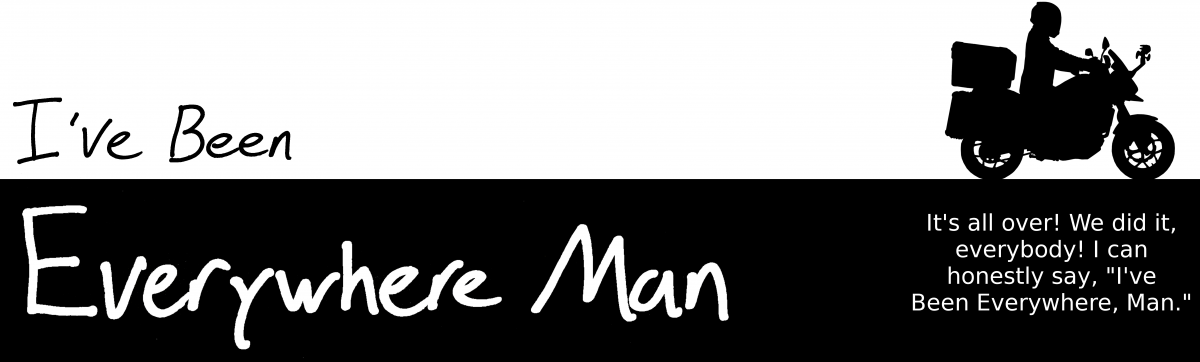
I hope to see “Everywhere Man” by Brett Anderson published in the future. 😉 Safe travels! 🙏🏻
LikeLike
Ha! Coming to a Barnes and Noble near you…..Wait do people still read books?
LikeLike
So cool you are doing this Brett!!! What an adventure 😃 I wouldn’t make it across Nebraska!
LikeLike
Don’t sell yourself short, Heidi. You’re tougher than you think. Remember, you still need to get to Germany sometime to practice what we learned from Frau Cook!
LikeLike
Miss you around the bus barn! Love your blog. What a great adventure! Been following you since the beginning. Roger
LikeLike
Thanks, Roger. I’ll miss you guys even more when I start seeing school buses back on the road. Just a bunch of tour buses up here…
LikeLike
Hi Brett,
What an adventure you’re on! It computes perfectly with me that you found the Wausa sign when you travelled through the Yukon! My dad LOVED the Alaska highway. After I moved here in 1980, my parents, Don and Marilyn Hult, made many trips from Nebraska to Alaska, camping along the way, bringing along grandkids one year, and stopping at favorite places like Liard hot springs and the signpost forest in Watson Lake. One year my mom and dad put up that Dalarna horse. How they would smile to see you there! My folks made it to Kodiak Island three times during their last decade (though I convinced them to fly up). Kodiak is a flight or a ferry ride from the mainland and has barely 100 miles of road system, but we do have warm, dry space for travelers if you decide to go someplace that Johnny Cash probably missed! Enjoy your journey and thanks so much for sharing it.
Carol Hult
LikeLike
Wow, thank you so much, Carol. I’m going to see if I can get your email from my folks and get in touch. Thanks so much for solving the mystery!
LikeLike